The Burr Trail
by Peter
The Burr Trail is a road in Garfield County. It runs from the town of Boulder, through Capitol Reef National Park and eventually to Bullfrog Marina on Lake Powell. I have only driven the section from Boulder to the Waterpocket Fold, a long monocline (a place where a fold in the earth's crust led to a large step between the higher land on the west and the lower land on the east).
The trail began in the 1800s as John Atlantic Burr (one of two babies born aboard the ship SS Brooklyn as it carried LDS settlers from New York to Oakland, California with the other named Georgiana Pacific Robbins) looked for ways to take his cattle from summer to winter range. This involved climbing up or down the Waterpocket Fold, a daunting task. Burr found a notch in the cliffs, Burr Canyon, that allowed a steep scramble on switchbacks up or down.
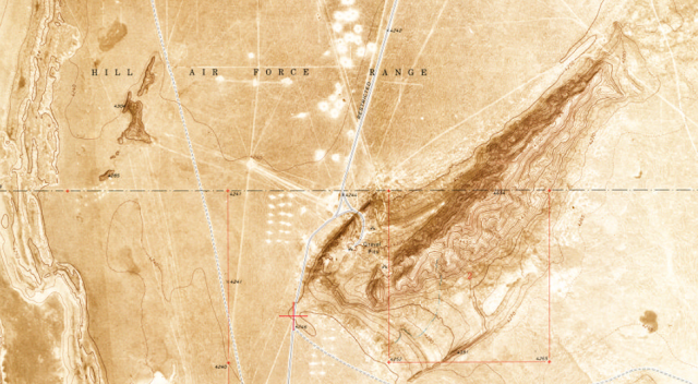
The trail remained essentially a cattle trail, particularly in the narrow, steep Burr Canyon until 1948. That's when the Atomic Energy Commission (AEC) came on the scene. They were tasked with finding enough uranium ore to provide for the needs of the nation's nascent military and peaceful nuclear programs. They did this primarily by guaranteeing the purchase of any uranium mined for about a decade. Southeastern Utah was a major source of uranium as evidenced by wildcat prospectors during the Moab uranium boom and the legacies of mills at Moab and Monticello.
The Capitol Reef area was only a minor part of this story, although you can go inside the Oyler mine adits (horizontal shafts) near Grand Wash. However, the AEC blasted a new road up Burr Canyon to open new areas for prospecting. This AEC road is now called the Burr Trail switchbacks, and driving it is not for the faint of heart. Not a lot came of this (aside from the small Rainy Day mine about 4 miles south), but along with the construction of a better road through Long Canyon to the west, opened up the area for new recreational opportunities, including hiking in Muley Twist Canyon and the Halls Creek Narrows. The road is paved (including through the beautiful Long Canyon) up to the boundary of Capitol Reef National Park, and is passable in a passenger vehicle beyond that. The switchbacks are nerve-wracking and do not have guard rails, but are drivable. If you keep your eyes open, you may see some rock art along the way. There's also a BLM campground at Deer Creek, although no water is available. You can continue along the Burr Trail east and out to Bullfrog Marina, although I haven't driven this route. You can also turn north at the bottom of the switchbacks and take Notom Road back up to Highway 24 a few miles east of Fruita.
The Burr Trail holds another interesting position in Utah history, as one of the first RS2477 roads that was legally adjudicated. Under an 1866 law meant to spur mining and other development, a road could be constructed and a right-of-way claimed across public land. That law was repealed in the reformation of Federal public land management in 1976, but existing rights-of-way were grandfathered in. Under RS2477, the right-of-way hadn't needed to be formally claimed, so that left a lot of potential rights-of-way hanging around. The Burr Trail was one of the earlier routes claimed and improved under this law, leading to a series of lawsuits between Garfield County and the Bureau of Land Management and National Park Service.
Eventually (in 1989), Garfield County won a right-of-way through a decision of the Tenth Circuit Court. However, their victory was not total, as the court also recognized the right and requirement of federal land managers to follow federal laws and policy (such as the National Environmental Policy Act and National Historic Preservation Act) in decisions regarding changes to the road. Essentially, the county has the right to maintain the road, but any changes need to go through the federal environmental process, with final approval by the BLM or Park Service. This has both set a precedent encouraging additional RS2477 claims (Utah currently claims over 36,000 miles of disputed right-of-way) and set important limits.
Further cases have established the requirement that the state and/or county prove 10 years of continuous use of a road before 1976.
If you visit the Burr Trail, you'll pass through Boulder, one of the last towns in Utah to receive its mail by mule (ending around 1935). If you want to drive the Burr Trail, you can stay in Boulder, Escalante, or Torrey. If you don't mind the cost, also check out the Boulder Mountain Lodge, which is fantastic, but expensive. The Hell's Backbone Grill, part of the same property, is also fantastic, and regularly earns rave reviews.
The Burr Trail is a road in Garfield County. It runs from the town of Boulder, through Capitol Reef National Park and eventually to Bullfrog Marina on Lake Powell. I have only driven the section from Boulder to the Waterpocket Fold, a long monocline (a place where a fold in the earth's crust led to a large step between the higher land on the west and the lower land on the east).
The trail began in the 1800s as John Atlantic Burr (one of two babies born aboard the ship SS Brooklyn as it carried LDS settlers from New York to Oakland, California with the other named Georgiana Pacific Robbins) looked for ways to take his cattle from summer to winter range. This involved climbing up or down the Waterpocket Fold, a daunting task. Burr found a notch in the cliffs, Burr Canyon, that allowed a steep scramble on switchbacks up or down.
 |
| Burr Trail Switchbacks. By Bob Palin (picture taken by Bob Palin with a Canon S40.) [CC BY-SA 2.5 (https://creativecommons.org/licenses/by-sa/2.5)], via Wikimedia Commons |
The trail remained essentially a cattle trail, particularly in the narrow, steep Burr Canyon until 1948. That's when the Atomic Energy Commission (AEC) came on the scene. They were tasked with finding enough uranium ore to provide for the needs of the nation's nascent military and peaceful nuclear programs. They did this primarily by guaranteeing the purchase of any uranium mined for about a decade. Southeastern Utah was a major source of uranium as evidenced by wildcat prospectors during the Moab uranium boom and the legacies of mills at Moab and Monticello.
 |
| The Burr Trail in Long Canyon |
The Capitol Reef area was only a minor part of this story, although you can go inside the Oyler mine adits (horizontal shafts) near Grand Wash. However, the AEC blasted a new road up Burr Canyon to open new areas for prospecting. This AEC road is now called the Burr Trail switchbacks, and driving it is not for the faint of heart. Not a lot came of this (aside from the small Rainy Day mine about 4 miles south), but along with the construction of a better road through Long Canyon to the west, opened up the area for new recreational opportunities, including hiking in Muley Twist Canyon and the Halls Creek Narrows. The road is paved (including through the beautiful Long Canyon) up to the boundary of Capitol Reef National Park, and is passable in a passenger vehicle beyond that. The switchbacks are nerve-wracking and do not have guard rails, but are drivable. If you keep your eyes open, you may see some rock art along the way. There's also a BLM campground at Deer Creek, although no water is available. You can continue along the Burr Trail east and out to Bullfrog Marina, although I haven't driven this route. You can also turn north at the bottom of the switchbacks and take Notom Road back up to Highway 24 a few miles east of Fruita.
The Burr Trail holds another interesting position in Utah history, as one of the first RS2477 roads that was legally adjudicated. Under an 1866 law meant to spur mining and other development, a road could be constructed and a right-of-way claimed across public land. That law was repealed in the reformation of Federal public land management in 1976, but existing rights-of-way were grandfathered in. Under RS2477, the right-of-way hadn't needed to be formally claimed, so that left a lot of potential rights-of-way hanging around. The Burr Trail was one of the earlier routes claimed and improved under this law, leading to a series of lawsuits between Garfield County and the Bureau of Land Management and National Park Service.
Eventually (in 1989), Garfield County won a right-of-way through a decision of the Tenth Circuit Court. However, their victory was not total, as the court also recognized the right and requirement of federal land managers to follow federal laws and policy (such as the National Environmental Policy Act and National Historic Preservation Act) in decisions regarding changes to the road. Essentially, the county has the right to maintain the road, but any changes need to go through the federal environmental process, with final approval by the BLM or Park Service. This has both set a precedent encouraging additional RS2477 claims (Utah currently claims over 36,000 miles of disputed right-of-way) and set important limits.
Further cases have established the requirement that the state and/or county prove 10 years of continuous use of a road before 1976.
 |
| Long Canyon from the Burr Trail |
If you visit the Burr Trail, you'll pass through Boulder, one of the last towns in Utah to receive its mail by mule (ending around 1935). If you want to drive the Burr Trail, you can stay in Boulder, Escalante, or Torrey. If you don't mind the cost, also check out the Boulder Mountain Lodge, which is fantastic, but expensive. The Hell's Backbone Grill, part of the same property, is also fantastic, and regularly earns rave reviews.
 |
| Oyster Shell Reef, off the Notom Road, just north of the Burr Trail |
Comments
Post a Comment